1

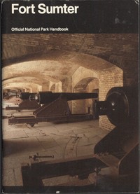
Fort Sumter: Anvil of War Fort Sumter National Monument, South Carolina — Reading Companion
259
3
Project Gutenberg
2017
Fort Sumter National Monument (Charleston, S.C.); Charleston (S.C.) -- History -- Civil War, 1861-1865; Fortification -- South Carolina -- Charleston
Readers of public-domain and historical texts
Project Gutenberg digital edition
en
Edition facts
Words: 17,596
Reading time: 77 min
Text sections: 3
Source:
Project Gutenberg record #55254
This National Park Service handbook examines Fort Sumter's construction on a man-made shoal, its role in the Civil War's opening shots, and the 587-day Confederate defense. The narrative moves from the fort's design to the 1863 bombardment that reduced it to ruins, using official reports and firsthand accounts.
Editorial Edition Score
4.5/5
★★★★★
★★★★★
Calculated from edition completeness, EPUB availability, text structure and catalogue metadata. Not a user rating.
Edition quality
The handbook opens not with the 1861 bombardment but with the fort's physical origins: a man-made island built on a shoal in Charleston Harbor. The phrase "the fort on the shoal" recurs as a structural motif, grounding the narrative in the site's engineered geography. The text moves deliberately from construction to crisis, then to ruin and preservation, mirroring the fort's own trajectory from planned stronghold to battered monument.
This structure—part history, part guide—uses official reports and firsthand accounts to trace how a single fort became both a symbol of secession and a target of sustained Federal assault. The 1984 handbook, part of the National Park Service series, balances technical detail with human drama, though its brevity leaves some transitions abrupt.
From Shoal to Stronghold
The handbook's first section emphasizes the fort's artificial foundation. Built on a submerged sandbar, Fort Sumter was designed as a masonry bastion, its walls thick enough to withstand naval bombardment. The text notes that Major Robert Anderson had never seen the fort before November 1860, underscoring the unfamiliarity of the site that would become his command. The narrative dwells on the fort's physical isolation—accessible only by boat, its guns commanding the harbor entrance. This focus on geography sets up the siege logic that dominates later chapters.
Recurring details include references to the fort's unfinished state at the outbreak of war, a fact that shapes both its vulnerability and its defenders' resourcefulness. The handbook uses the phrase "the fort on the shoal" repeatedly, tying the structure's identity to its precarious foundation.
The First Shot and Its Aftermath
The account of April 12, 1861, is concise: a mortar shell from Fort Johnson "burst almost directly over Fort Sumter." The handbook does not linger on the symbolism but moves quickly to the fort's surrender and Anderson's evacuation. The narrative then jumps to 1863, when the fort, now in Confederate hands, becomes the target of a prolonged Federal campaign. This temporal leap is the text's most significant structural gap—the intervening two years are compressed into a single paragraph.
The handbook relies on official reports, quoting General Gillmore's description of the bombardment as "a spectacle of surpassing sublimity and grandeur." Such language contrasts sharply with the grim statistics: over 7,300 rounds fired against the fort between August 17 and September 2, 1863. The text notes that by September 24, Gillmore reported the "practical demolition" of the fort, yet the garrison held on.
The 587-Day Defense
The handbook's central section details the Confederate defense from 1863 to 1865, emphasizing the fort's transformation from a masonry bastion into a rubble heap that still resisted capture. The phrase "shapeless and harmless mass of ruins" appears in a Federal report, yet the garrison continued to occupy the site. The narrative highlights the role of ironclad warships, particularly the New Ironsides and five monitors, which bombarded the fort on the night of September 1-2, 1863. The defenders, lacking guns to reply, could only endure what the text calls the "sneaking sea-devils."
The account of Battery Wagner on Morris Island provides a parallel story: the assault by the 54th Massachusetts Infantry, led by Colonel Robert Gould Shaw, who shouted "We shall take the fort or die there!" before being killed. The handbook notes that 9 of 10 Union regimental commanders were killed or wounded, and the 54th lost nearly 40 percent of its men. This episode, though not at Sumter itself, illustrates the broader campaign's human cost.
Ruin as Monument
The final section shifts from wartime narrative to postwar preservation. The handbook describes the fort's physical state after the war: a shell-pocked ruin, its interior gutted by explosions and fire. The text traces the site's transition from active fortification to national monument, emphasizing the paradox of preserving a structure defined by its destruction. The guide includes a walking tour of surviving features: the sally port, left-flank casemates, and the garrison monument.
This section is the most practical, listing points of interest such as Fort Moultrie, James Island, and Castle Pinckney. The handbook's dual identity—as both historical account and visitor guide—becomes explicit here. The narrative suggests that the fort's meaning lies not in its original design but in the scars of its bombardment, a theme that echoes the earlier description of the "shapeless mass of ruins."
The handbook's value lies in its concrete details: the number of rounds fired, the names of commanders, the precise dates of bombardments. Readers should note the text's reliance on official reports, which lend authority but also filter out civilian perspectives and the experiences of enslaved people who built the fort's defenses. The guide's brevity means that major events—the 1861 surrender, the 1863 naval attacks—are covered in a few paragraphs each. For a fuller picture, consult the works listed in the "For Further Reading" section, which includes primary sources and scholarly histories.
Reader reflection
How will you remember this book?
Save your reaction, strongest insight, and memorable passage.
Your progress
0
/
10
2
How did the book work for you overall?
3
Would you encourage someone else to read it?
4
Did the language feel accessible?
5
Did this book create an emotional response?
6
Was the book moving at the right speed?
7
How personally connected did you feel to the book?
8
Would a second reading be valuable?
9
What did this book teach you most?
10